

 Veuillez vous connecter pour afficher les coordonnées.
 5x Trouvé
  0x Non Trouvée
  0 notes
  0 observateurs
  Évalué comme: n/a


 Attributs de cache


 Description
EN
Description
EN
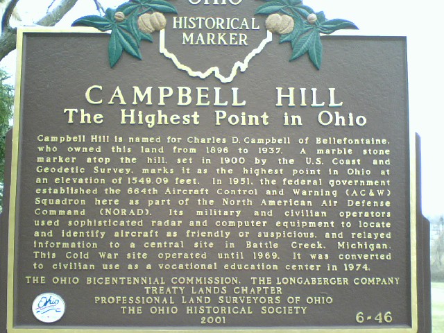
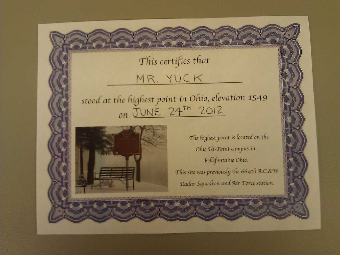
The High Point of Ohio (1,549 ft.), commonly known as Campbell Hill, is in Western Ohio, within the City limits of Bellfontaine, although in a semi-rural area. It sits on the grounds of a Vocational School called the Ohio Hi-Point Center, which was originally a cold war era Air Force Radar facility that was converted to Civilian use in 1974. Makes sense, I suppose, a radar facility at the highest point for several hundred miles in the relatively low Mid-Western U.S..
That being said, the high point is obviously on private property in a gated facility, and is open for acess the following hours:
- Monday-Friday: 6:30 AM - 10:00 PM
- Saturday: 7:00 AM - 7:00 PM
- Sunday: Closed
HOWEVER by calling the Hi-Point Center's buildings and grounds office (a suggestion I saw on a peak bagging website), I was easily able to obtain permission to visit on a Sunday, and the nice lady even told me where there was a walk-in gate in the fence. Turns out I didn't need this though, because there was an Air Force Squadron reunion on the Sunday of my visit. I can't speak for her giving you permission to visit at 2:00 AM or anything like that though.
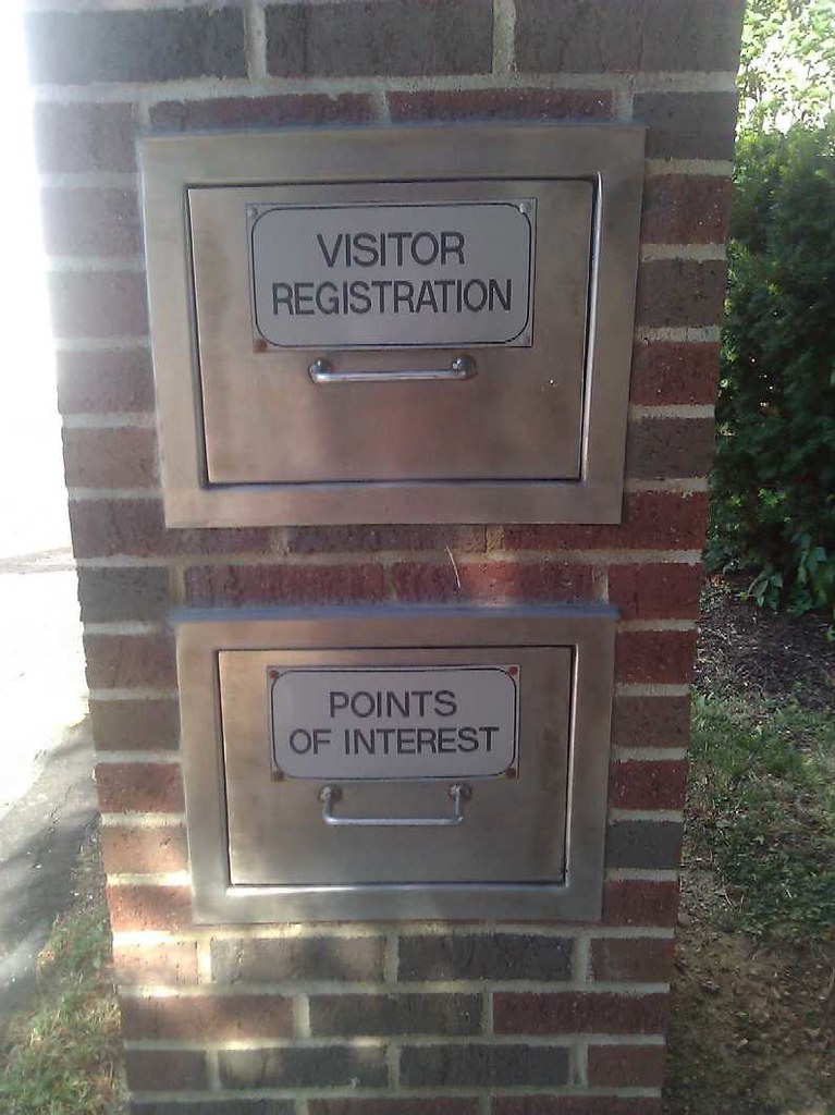
Your mission is to go to the High Point of Ohio, and open this top drawer:
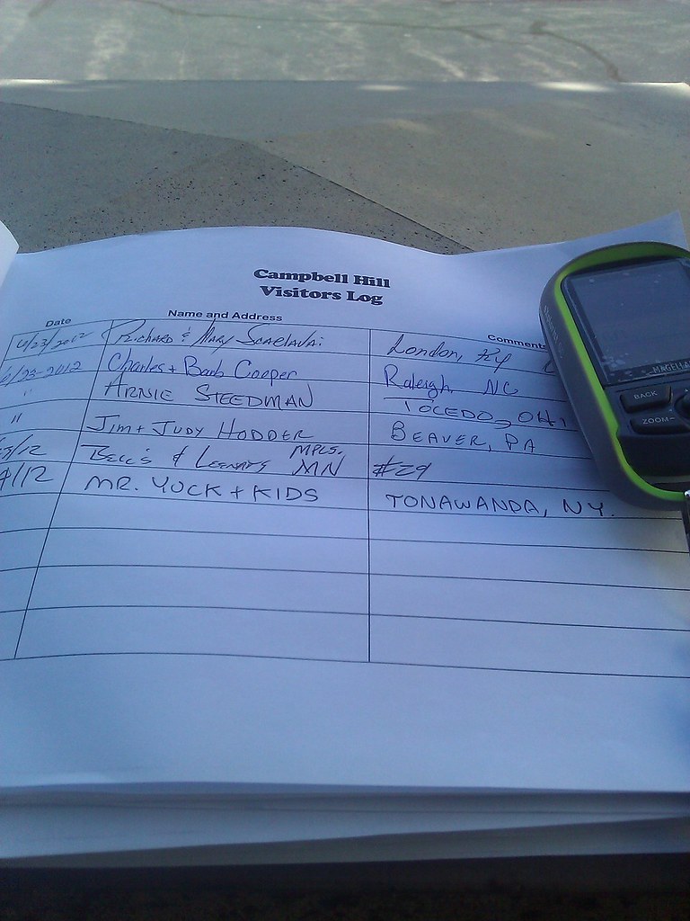
And take a picture of your entry in this Summit Register. This is your logging requirement. Preferably, of course, without cutting off the date of your visit, like I did: But hey, the important thing is to get the "Campbell Hill visitors log" in there. GPS optional. Note there are also nice "fill out yourself" certificates to document your visit. I have uploaded a picture of mine at the bottom of this cache page.
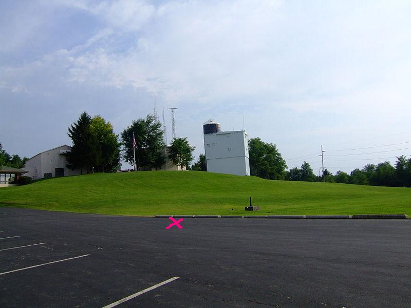
Enjoy your visit! You can drive to within probably 75 feet of the high point, and it is handicap acessable. But check out the picture from Wikipedia I uploaded to the bottom of the cache page, and park where the "X" is like I did, for about a 30 foot climb on mowed grass for a "summiting experience". On the Groundspeak side, you will find a Waymark in 6 different categories, as well as an Earthcache. The benchmark you see at the top is not a USGS benchmark loggable on Geocaching.com; best I can tell it's a U.S. Army Corps of Engineers benchmark, and is not Waymarked.
 Images
 Entrées du journal:
5x
0x
0x
Entrées du journal:
5x
0x
0x


