

 Please log in to see the coordinates.

 Rated as: n/a


 Cache attributes


 Description
EN
Description
EN
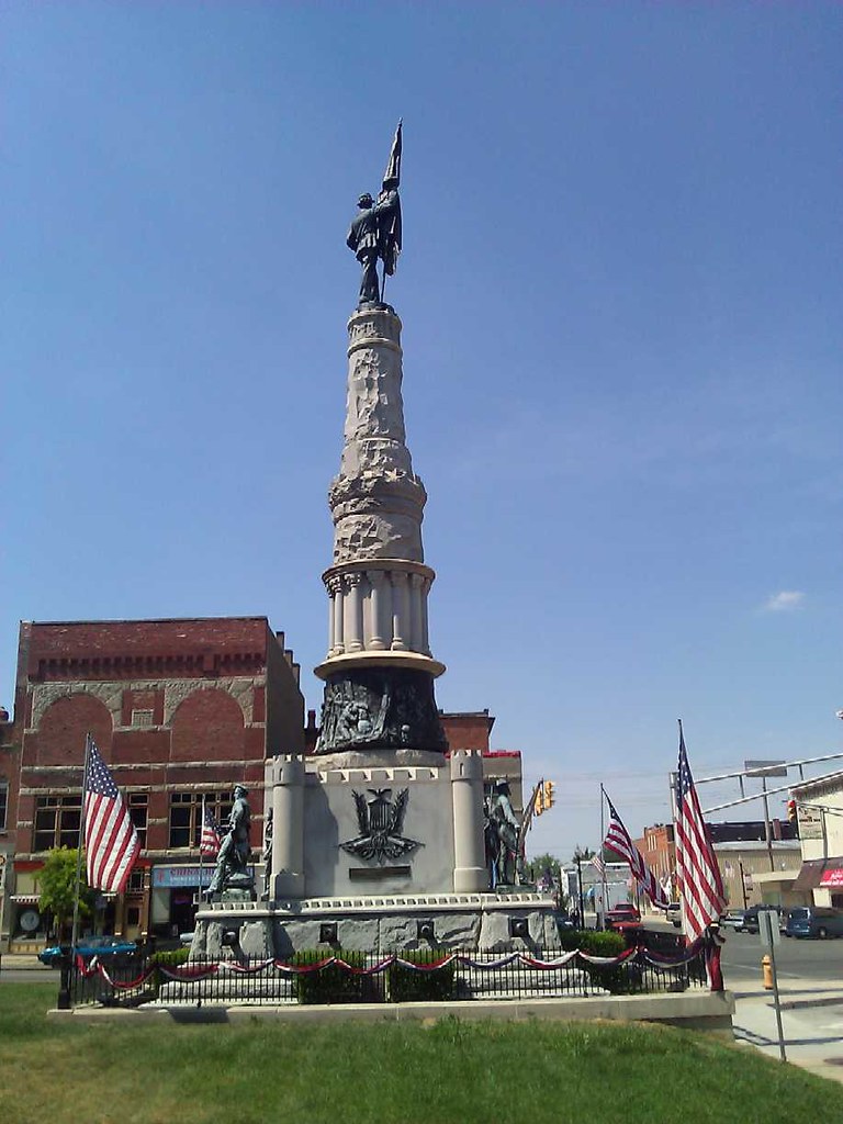
The Randolph County Soldiers and Sailors Monument is located in Downtown Winchester, Indiana (Pop. 5,000) and sits on the grounds of the Randolph County Courthouse. This is a very impressive Monument, whose height I am going to guestimate at 50-60 feet. I have to do this, because this Monument is not very well documented on the Interwebs. Here is about the best documentation you are going to find, at HMdb.org (Historical Markers Data Base). There is also some interesting information on a page by a guy from the Winchester High School class of '67 which contains a photo of the sculptor and the top flag bearer statue. You can click that photo, or any others on that page to enlarge.
Constructed of Granite, the Monument has 4 bronze statues on each corner with their bases about 6 feet off the ground (sidewalk level), and a flag bearer statue on top, whose height I would estimate to be about 20 feet with the flag. There is also a bronze wrap cut in relief at the base of the shaft of the monument. It was erected 1889-1890, and dedicated in 1892.
The driving force behind the monument was James Moorman, a local banker who donated the very sizeable sum of $2,000 back in the late 1800's. You can read all about him at a plaque on site, or click on the image on the HMdb.org webpage to enlarge a picture of that plaque. Mr. Moorman was quite the Philanthropist; the most interesting thing to me about this monument is it's physical size., rivaling the Civil War Memorials you can find downtown in almost every major east coast City in America. I was quite shocked to see such a Memorial in a very small City.
Logging requirements
- Have your picture taken with the Monument in the background, or a picture of your GPS with the Monument if caching by yourself.
- Find the "Randolph County" Marker set into the ground on the North side of the Monument. Complete this sentence: "An ____ log structure" You are looking for a 4 digit year. This is your logging password.
This virtual cache is an Opencaching.US exclusive. This impressive Monument is not documented on any other GPS gaming website, including Waymarking.com. As a matter of fact, the coordinates were obtained from Google Earth, as I assumed it "had to be a Waymark", and I didn't even snap my own set.
 Log entries:
 1x
1x
 0x
0x
 1x
1x


