

 Log in om de coördinaten te kunnen zien.
 2x Gevonden
  0x Niet gevonden
  0 Opmerkingen
  0 Volgers
  Beoordeeld als: n/b


 Cache attributen


 Beschrijving
EN
Beschrijving
EN
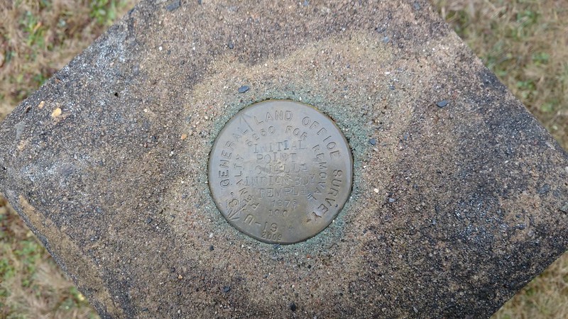
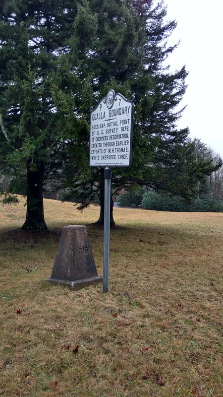
DESIGNATION - Q 1 B BOUNDARY MARKER
PID - FB1570
STATE/COUNTY- NC/JACKSON
USGS QUAD - SYLVA NORTH (1978) DESCRIBED BY NATIONAL GEODETIC SURVEY 1938
AT SOCO GAP, ON THE HAYWOOD-JACKSON COUNTY LINE, ON STATE HIGHWAY 293, ON THE PROPERTY OF THE QUALLA INDIAN RESERVATION, AT THE SUMMIT OF SOCO GAP, 100 FEET EAST OF THE JUNCTION OF A T-ROAD LEADING SOUTHEAST, 60 FEET SOUTH OF A FENCE CORNER, 41.5 FEET NORTHWEST OF THE NORTHEAST CORNER OF A LOG CABIN, 26.5 FEET SOUTHEAST OF THE CENTER LINE OF THE ROAD, AT THE INTERSECTION OF A WIRE FENCE AND A PICKET FENCE, AND 6 FEET SOUTHEAST OF THE CORNER OF THE PICKET FENCE. A UNITED STATES GENERAL LAND OFFICE STANDARD DISK, SET IN THE TOP OF A LARGE POST 30 INCHES AT THE BASE AND 14 INCHES AT THE TOP AND PROJECTING 4 FEET ABOVE GROUND.
From Wikipedia, the free encyclopedia:
The Qualla Boundary or The Qualla is territory held as a land trust for the federally recognized Eastern Band of Cherokee Indians, who reside in western North Carolina. The area is part of the Cherokees' historic territory. As a trust, the land is technically not a "reservation" per se, as the land was not "reserved" by the federal government; it was purchased by the tribe in the 1870s and subsequently placed under federal protection. Individuals can buy, own, and sell the land, provided they are enrolled members of the Tribe of the Eastern Band of the Cherokee Indians.
The main part of the Qualla Boundary lies in eastern Swain and northern Jackson counties (just south of Great Smoky Mountains National Park). A small portion of the main trust lands extends eastward into Haywood County. The trust lands include many smaller non-contiguous sections to the southwest in Marble, Hiawassee and Hanging Dog areas of Cherokee County, North Carolina and the Snowbird community in Graham County, North Carolina.
As with any Virtual geocache or Benchmarking, photo proof of visit is required.
 Logs:
2x
0x
0x
Logs:
2x
0x
0x


