 Log in om de coördinaten te kunnen zien.
 2x Gevonden
  0x Niet gevonden
  0 Opmerkingen
  2 Volgers
  Beoordeeld als: n/b
 Cache attributen

 Beschrijving
EN
One of our
Delicate Arch is located in Arches National Park
Parking for the hike to Delicate Arch:
To get credit and
Please do not
#1: Hike to Delicate Arch and post a
One of our State's Crown Jewels
Delicate Arch

National Park Service Photo
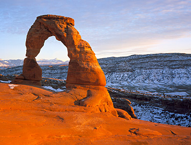
Delicate Arch is located in Arches National Parknear the town of Moab in Southeastern Utah. It is an amazingnatural formation and is proudly displayed on most Utah LicensePlates and on the signs you may see when entering the State.
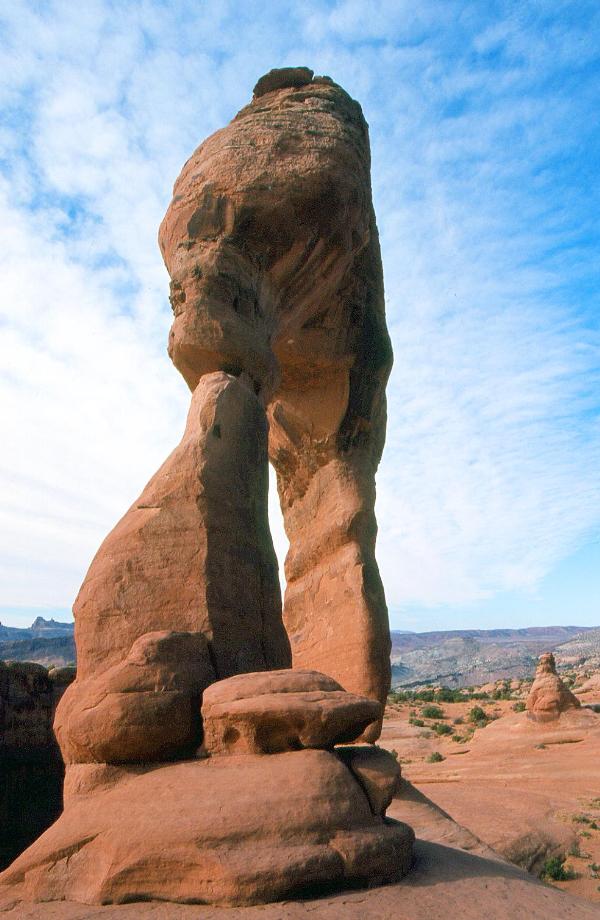
Delicate Arch stands alone at almost 5000 feet above sea-level. Itis estimated that it took about 70,000 years for it to be createdby frost, water and wind. Because of the narrow segment on theArch’s one side, it has the potential to collapse in the geologicfuture. Delicate Arch is about 65 feet wide and about 85 feet high.It is formed from the Slickrock and Moab Tongue layers of theEntrada Sandstone. This arch also has no supporting fins that arevisible on most other arches and there is no sign of debris thathad fallen or been removed during it creation.
There are many ways to enjoy Delicate Arch and it is highly recommended and rewarding to hike to it from the Wolfe Ranchparking area. The hike will take you 2 to 3 hours and is about a 3mile round trip with a 480 feet elevation gain. There is also twoadditional view points further down the road. The Upper View pointis about a 20 minute hike of about ½ mile and the Lower View pointis 100 yards on flat terrain.

National Park Service Photo
Parking for the hike to Delicate Arch:
N38 44.150 W109 31.245
Parking for Upper and Lower View Point:
N38 44.055 W109 30.130
Upper View Point:
N38 44.268 W109 30.055
Lower View Point:
N38 44.068 W109 30.015
To get credit and claim a “Find” for this Cache you must complete any task fromthe list below and let us know how many people were in yourparty.
Please do notinclude your answers on the Cache page.
Failure to complete a requirement from the list will result in yourlog being deleted.
#1: Hike to Delicate Arch and post apicture of yourself/s with your GPS at or under Delicate Arch (notfrom across the canyon) on the cache page and tell us via emailsomething about Delicate Arch that you learned from visiting theArch.
#2: Post a picture of yourself/s with yourGPS on the Cache page with Delicate Arch in the background from theUpper View Point and tell us via email how many Fence Posts youpassed on your left getting up to the view point.
or
#3: Post a picture of yourself/s with yourGPS on the Cache page with Delicate Arch in the background from theLower View Point and tell us via email which object to the right ofthe Arch looks most like a Spinx.
or
#4: Post a picture of yourself/s on the Cachepage with Delicate Arch in the background from any of thecoordinates listed above and tell us via emal how Arches areformed.
 Logs:
Logs:
 2x
2x
 0x
0x
 0x
0x


