

 Autentifică-te pentru a putea vedea coordonatele.
 0x găsit
  0x negăsită
  0 Comentarii
  1 utilizatori care urmăresc această geocutie
  Apreciată ca: -


 Atribute


 Descriere
EN
Descriere
EN
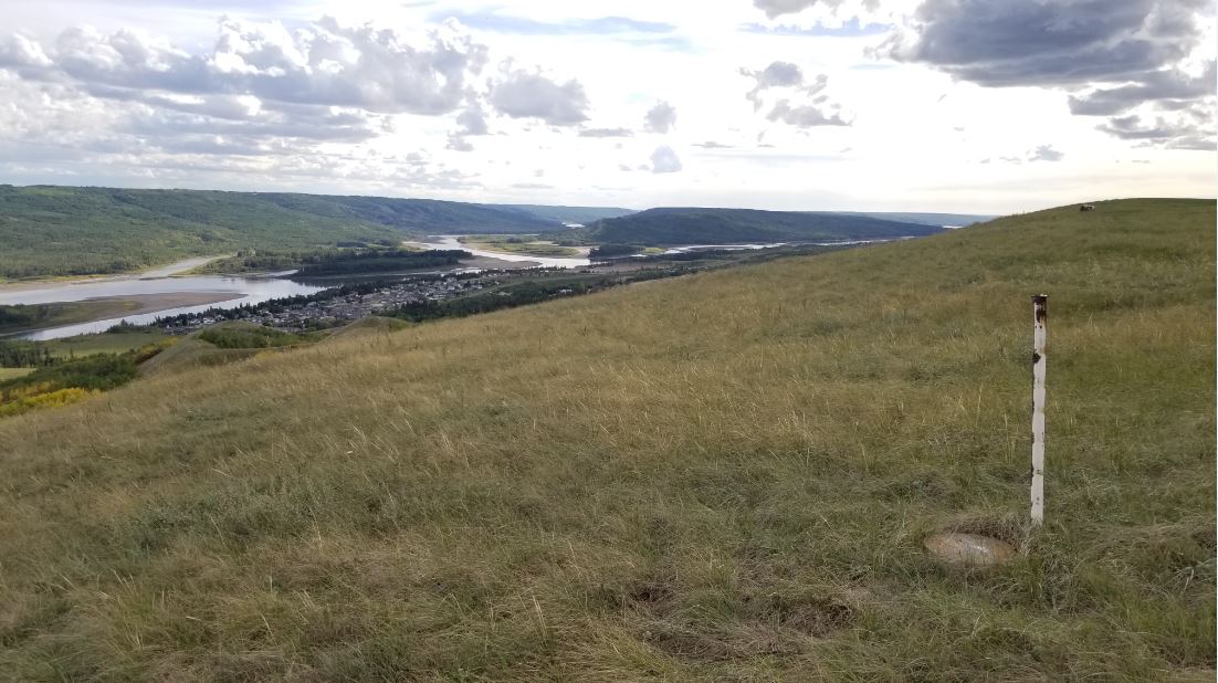
"Misery" station is a High Precision 3D control station established by the Geodetic Survey of Canada. Located near the summit of Misery Mountain in Peace River, Alberta. This may be private land (there is a downhill ski operation on the hill) but is freely accessed during off season. You can park in the residential area to the west (see additional waypoints) and follow the established trails to reach the summit. expect to take between 30-60 minutes depending on your speed. Yes it is an uphill hike! Enjoy the spectacular views of the Peace River Valley from the summit. To log this cache, please upload a photo showing you (or some identifiable item, such as a handheld GPS unit, or even your foot) along with the survey disk.
Here is a link to the Station report: https://webapp.geod.nrcan.gc.ca/geod/data-donnees/station/report-rapport.php?id=706004

 Puncte suplimentare
| Etapă | Simbol | Tip | Coordonate | Descriere |
|---|---|---|---|---|

|
Început de traseu | --- | Parking and trailhead |
 Pictures
 Însemnări în jurnal:
0x
0x
0x
Însemnări în jurnal:
0x
0x
0x


