

 Autentifică-te pentru a putea vedea coordonatele.
 0x găsit
  0x negăsită
  0 Comentarii
  0 utilizatori care urmăresc această geocutie
  Apreciată ca: -


 Atribute


 Descriere
EN
Descriere
EN
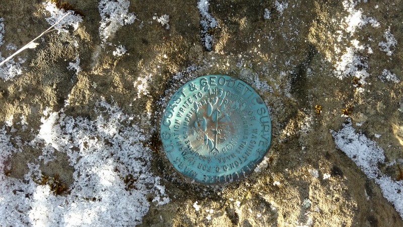
DESIGNATION - HIGH KNOB 2
PID - GA3420
STATE/COUNTY- VA/WISE
USGS QUAD - NORTON (1981)
DESCRIBED BY COAST AND GEODETIC SURVEY 1933 (MAH)
STATION IS ON THE SUMMIT OF A BARE-TOPPED KNOB, ABOUT 3 MILES SW OF NORTON, VA.
STATION IS LOCATED ON THE E EDGE OF THE SUMMIT, 13 FEET NE OF THE NE CORNER OF A LOG CABIN. THERE WAS AN OLD U.S.G.S. STATION ON THIS POINT, BUT IT HAD BEEN DUG OUT AND ROLLED DOWN THE HILL.
STATION HIGH KNOB 2 IS LOCATED NEAR THE SITE OF THE OLD U.S.G.S. STATION, AND THE REFERENCE MARKS WERE SET IN THE DRILL HOLES OF THE OLD REFERENCES.
SURFACE AND UNDERGROUND MARKS ARE STANDARD BRONZE DISKS SET IN CONCRETE, AS DESCRIBED. REFERENCE MARKS ARE STANDARD DISK REFERENCE MARKS WEDGED N DRILL HOLES IN BOULDERS.
REFERENCE MARK NO. 1 IS LOCATED AT THE SOUTHERN EXTREMITY OF THE BARE TOP. REFERENCE MARK NO. 2 IS SW FROM THE STATION AND 44-1/2 FEET FROM THE SE CORNER OF THE LOG CABIN. REFERENCE MARK
NO. 3 (AZIMUTH MARK) IS 150 YARDS NE FROM THE STATION AT THE FOOT OF KNOB, ALONG THE TOP OF THE RIDGE, 20 FEET W OF THE CENTER LINE OF ROAD LEADING TO THE STATION.
TO REACH FROM NORTON, FOLLOW U.S. HIGHWAY 23 S THROUGH THE TOWN. AT A POINT WHERE U.S. HIGHWAY 23 TURNS SW AFTER CROSSING THE RAILROAD TRACKS, TAKE DIRT ROAD GOING E BY THE OLD DOMINION ICE PLANT 4.7 MILES UP THE MOUNTAIN TO THE STATION.
HEIGHT OF LIGHT ABOVE STATION MARK - 1-1/2 METERS.
Coordinates are spot on, physical discription is set in a boulder 30 feet from top of steps at the end of the parking lot on the left side of trail to the obersavation tower.
As with any Virtual geocache or Benchmarking, photo proof of visit is required.
 Însemnări în jurnal:
0x
0x
0x
Însemnări în jurnal:
0x
0x
0x


