

 Zaloguj się, by zobaczyć współrzędne.
 0x znaleziona
  0x nieznaleziona
  0 komentarze
  0 obserwatorów
  Oceniona jako: b.d.


aby zobaczyć współrzędne oraz
mapę lokalizacji skrzynki
 Atrybuty skrzynki


 Opis
EN
Opis
EN
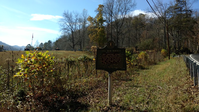
Marker title: Civil War Routes
Marker Number: 570
Location: In Harlan County 4 mi. S. of Cawood on US 421.
Description:
This area important passageway for Union and Confederate forces. USA moved along Poor Fork and CSA along Clover Fork of Cumberland River; each route reflected local sentiment. February 1862 USA forces under Brig. Gen. T. T. Garrard, grandson of Ky.'s second governor, camped here. Later CSA troops under Gen. H. Marshall camped here.
About the geocache placement.
The geocache is a camo lock-n-lock container placed near the historical marker on the outside of the cemetery fence under a large boulder.
Logging code is in the top of the container.
Do not attempt this cache after dark. It's in Harlan County, enough said.
 Dodatkowe waypointy
| Symbol | Typ | Współrzędne | Opis |
|---|---|---|---|

|
Parking | --- | Parking Area |
 Wpisy do logu:
0x
0x
0x
Wpisy do logu:
0x
0x
0x


